About the Region
Metroparks and Lucas County are located primarily within the Maumee River Watershed, the largest in the Great Lakes Basin.
The Great Lakes are the largest system of fresh surface water on earth, containing approximately 21% of the world’s fresh surface water. Bordering Lake Erie, Toledo is a component of the Great Lakes basin. The Maumee and Ottawa River Watersheds, as part of this area, are all important pieces of our natural heritage.
In addition to our crucial position in the Lake Erie watershed, Metroparks and Lucas County are uniquely situated in an area that spans four varied and critical ecosystems: the Lake Erie Coastal Marsh Zone, the Great Black Swamp, the Maumee River, and the Oak Openings Region. Some of the unique natural resources within these different ecosystems include: the easternmost population of Lark Sparrows, the largest walleye run in the world, the greatest number of rare plant species in Ohio, and critical habitat for the state-threatened Blanding’s Turtle. Metroparks Toledo is committed to preserving and restoring these natural resources and sharing them with the community. Read on for more details about these varied ecosystems that can all be found within the park district.
Lake Erie Coastal Marsh Zone
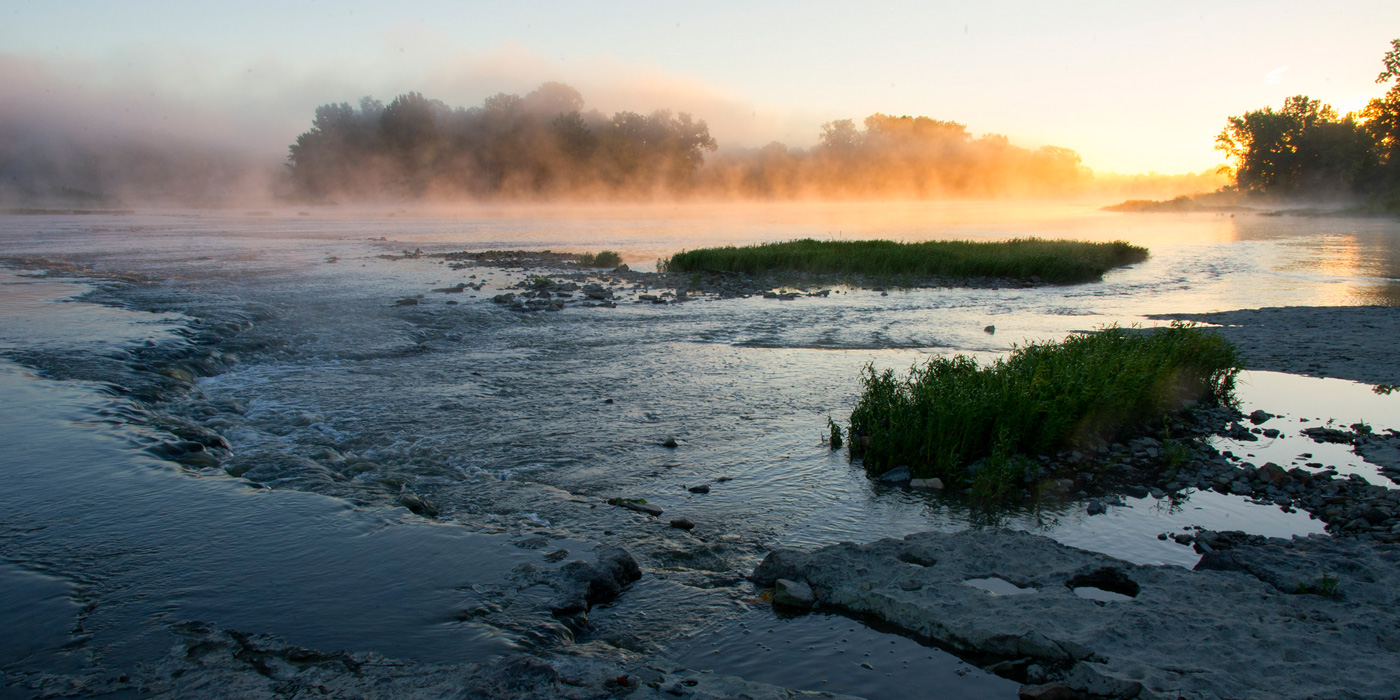
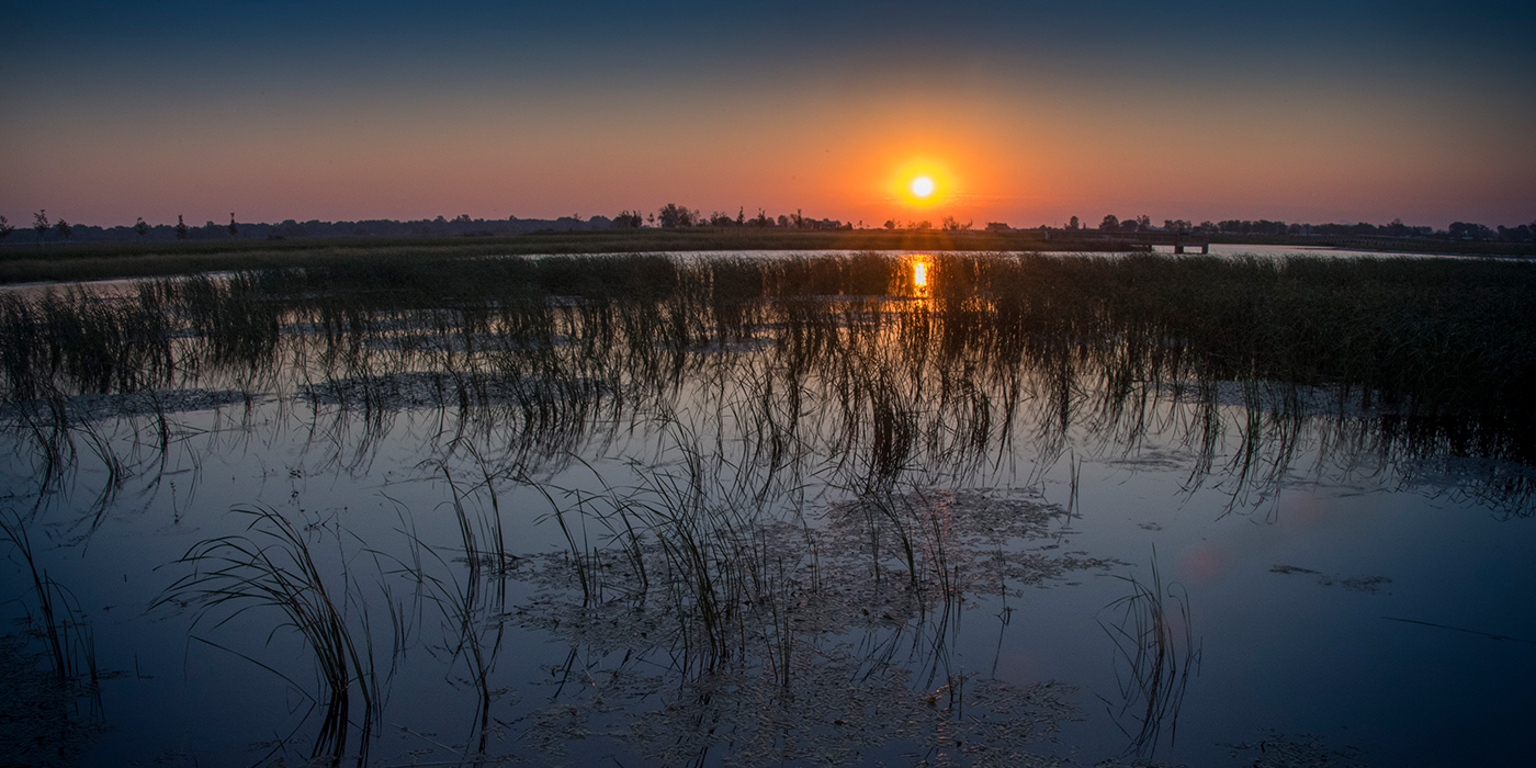
For thousands of years, the entire southwest shore of Lake Erie was bordered by marshland and swamp forest. Presently, only about 5% of the original, historic coastal wetlands in the western portion of Lake Erie remain, due primarily to the draining of the land and conversion to agriculture over the last century and a half. Lake Erie’s remaining coastal wetlands are unparalleled and serve as natural buffers for flooding; they also act as important filters for clean water. Much of Lake Erie’s biological diversity and productivity occurs within this ecosystem, due to the wealth of unique habitats found here. Most of the remaining coastal marshes are protected as parks or preserves, including Ottawa and Cedar Point National Wildlife Refuges, Maumee Bay State Park, Magee Marsh Wildlife Area, and Howard Marsh Metropark.
In spring and fall, the marshes are critical stopover sites for migrating songbirds, waterfowl, shorebirds and raptors, offering shelter and food on their long journeys to and from their breeding grounds. For breeding birds, dense thickets of shrub-scrub provide good habitat for nesting and roosting. Nearshore areas of this zone are important for fish, which use it for spawning and feeding, offering excellent foraging opportunities for herons and egrets that nest on nearby West Sister Island, ensuring their breeding success. Adjacent wetlands and shallow emergent marsh encompassing grassy and sparser cattail vegetation are communities that are widely used by nesting waterfowl, rails, marsh wrens and sparrows. Open pond habitat provides good sites for turtles, water and fox snakes, muskrats, aquatic insect larvae, leopard and bullfrogs.
Bordering swamp forests are also an important component of this zone and include a number of hardwood trees, as well as cottonwoods and sycamores. These towering trees offer vertical habitat for nesting bald eagles and other raptors. Parts of this swamp woodland blended with the edges of the Great Black Swamp, also located in northwest Ohio.
The Great Black Swamp
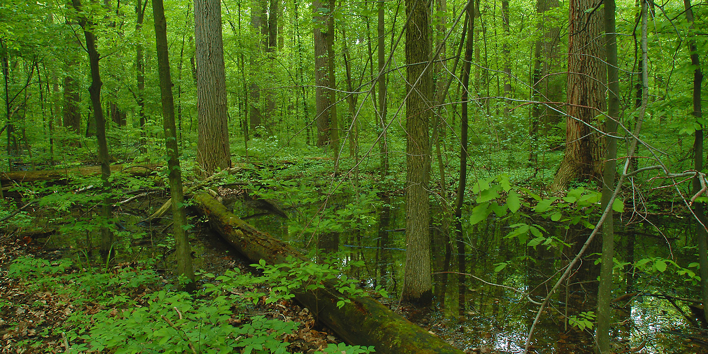
The Great Black Swamp once covered approximately 1,500 square miles encompassing an enormous thirty-mile strip along the southern and eastern banks of the Maumee River. It extended from Maumee Bay and Sandusky Bay in northwest Ohio to the headwaters of the Maumee River, near present day New Haven, Indiana. The vast swamp was actually the geologic remainder of the bottom of an earlier predecessor of Lake Erie.
As the glaciers retreated thousands of years ago, the lake level dropped and the swamp surfaced, exposing the thick, dark, clayey soil of the postglacial lakebed. On this unique, sticky wetland soil that gave the swamp its name, grew a forest very densely packed with massive hardwoods, yet was also home to a network of wetlands and wet prairies—especially east of Toledo.
It stretched, unbroken, from the Maumee River to Port Clinton with branches and foliage so thick that they filtered out sunlight and muffled sound. Early settler reports dismally portrayed the region as being the most forsaken, desolate, inhospitable wilderness in America, due to its ability to hold large amounts of water and produce an extreme number of mosquitoes.
Gray wolves, elk, cougars, bobcats, lynx and black bears once roamed the great black swamp, yet were extirpated throughout the early to mid-nineteenth century, succumbing to the effects of deforestation, drainage, and roads. Today, just a mere shadow of this primeval habitat is left of what once was considered “great,” both in size and tree girths.
Scattered descendants of those lofty trees still sprout here and there as reminders, and protected sites like Pearson Metropark and Goll Woods State Nature Preserve that showcase the native woodland diversity can still be visited today; however, no place can compare to the swamp’s former greatness.
The Maumee River and Tributaries
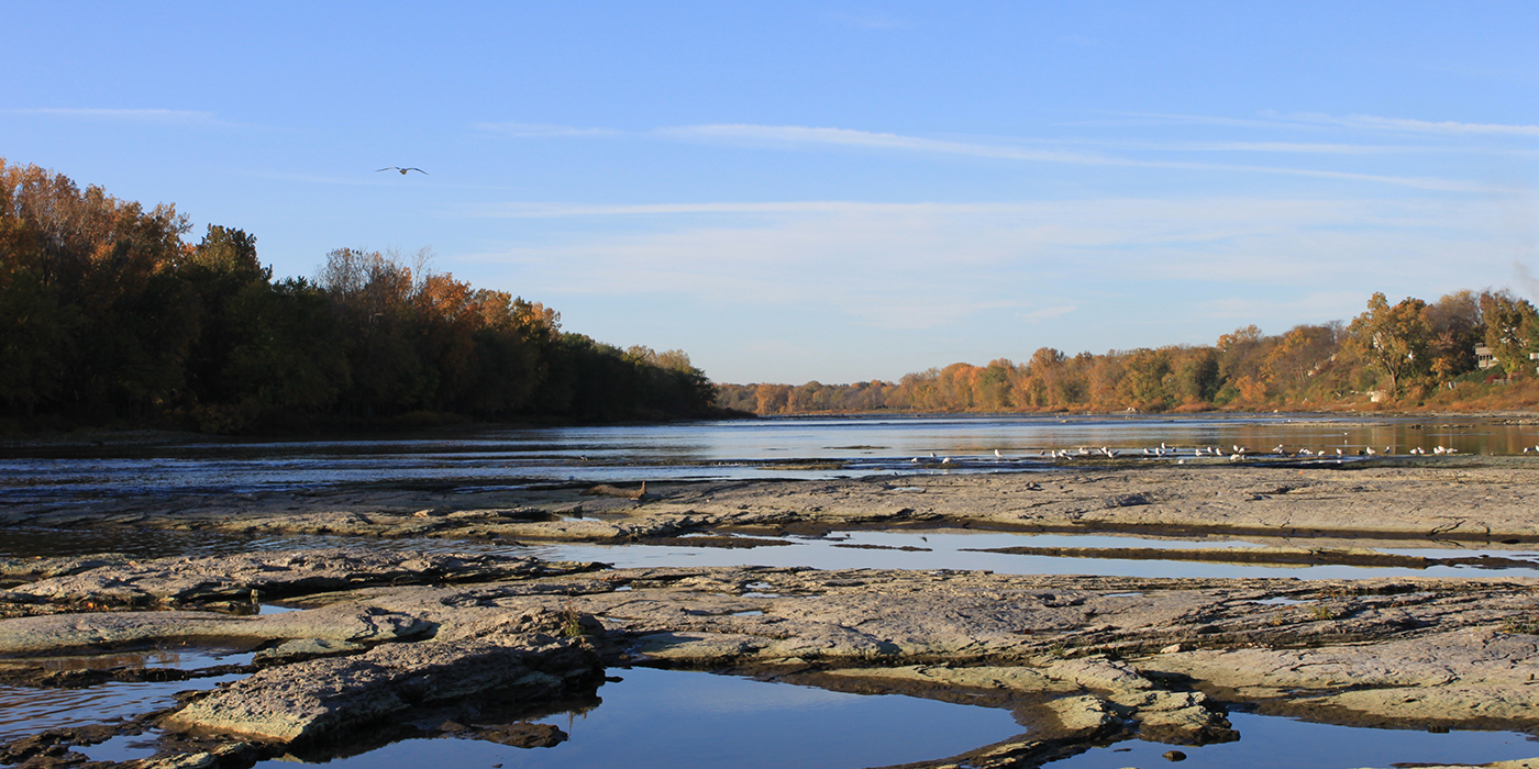
Also referred to as the “Mississippi of the Great Lakes,” the Maumee River encompasses a watershed that is actually considered small in comparison to the Mississippi; however, it is the largest in all of the Great Lakes, at over 6,000 square miles! This drainage system is fed by streams that flow through 17 counties in Ohio and parts of Michigan and Indiana.
The foundation or bedrock that comprises the base of this mighty river is 400 million year old dolomitic limestone. Land on either side of it is referred to as floodplain-- an important ecosystem component, essential for holding back floodwater, retaining ice floes, slowing erosion, and filtration.
Riparian corridors, which encompass floodplain forests adjacent to the river and other local tributaries, not only serve in a critical role for protecting water quality, but are also essential for important migratory bird stopover habitat and breeding birds. Other wildlife like turtles, snakes, cricket frogs, bats, beaver, and white-tailed deer utilize these sites for breeding, cover, and foraging. Well-oxygenated, Maumee River “rapid” areas and rock ledges within these watery confines serve as macroinvertebrate havens. Here, stoneflies, mayflies and other aquatic macroinvertebrates live out their lifecycles, critical fodder for the masses of hungry walleye and other fish that migrate through or spawn there.
The tree species growing within this ecosystem are well adapted to these wetland environments and able to provide a great amount of environmental benefits by absorbing large quantities of rainwater, further aiding in the reduction of runoff and sediment deposits after storms. Water quality in other, nearby tributaries is, therefore, improved as a result of these systems.
Metroparks Toledo has numerous parks along the banks of the Maumee, including Glass City, Middlegrounds, Side Cut, Farnsworth, Bend View, and Providence Metroparks.
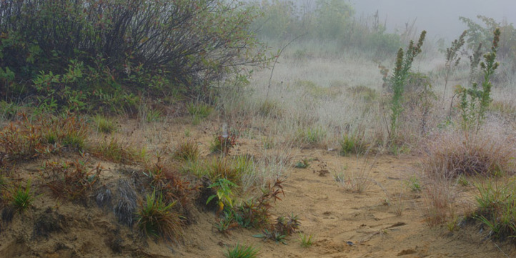
The Oak Openings
The Oak Openings Region is a sandy, five mile swath that stretches southwestward over 80 miles through Wayne and Monroe counties in Michigan and Lucas, Henry, Fulton and Wood counties in Ohio. As the last glacier receded, some 13,000 years ago, it left Lake Warren (an early predecessor of Lake Erie), to create sandy beaches in what is now considered the Oak Openings Region.
As water levels gradually dropped to what we see today, these sandy areas were left high and dry to be sculpted by the wind into ridges and dunes over time. Below the sand, a nearly impervious layer of clay holds water year round.
In some places where the sand is several feet thick, drought tolerant plants like prickly pear cactus grow among other upland prairie species. Where the sand layer is thin and the clay is closer to the surface, wetland plants like rushes and sedges thrive. Desert-like (dune) conditions that exist in close proximity to wet pockets (swales) or wet prairies is what creates the perfect environment to showcase the region’s biodiversity that exists within its special communities.
A plant community is an assemblage of species that interact with one another and their environment within a certain area. Environmental or abiotic factors such as climate, geology, hydrology, soils, and topography are important in determining where plant communities occur. In fact, Lucas County tops all other Ohio counties with the highest totals of rare, state-listed plant species with some of the rarest plant communities in the world.
Five community types are actually ranked “globally rare.” The unusually diverse array of these plant communities attracts a wide variety of noteworthy wildlife species, such as Lark Sparrows, Blue Racers, and Blanding’s Turtles. These globally rare plant communities are:
- Black Oak/Lupine Barren
- Midwest Sand Barren
- Mesic Sand Tallgrass Prairie
- Twigrush Wet Prairie
- Great Lakes Pin Oak/Swamp White Oak Flatwoods